This is the most popular trip on the Bois Brule for less-experienced canoers and kayakers. From Stone's Bridge, the river flows through a long flatwater stretch of coniferous bog. Thickets, sedge, tall marsh grasses, and scrub pines dominate the riverbanks. Eventually the marsh gives way to beautiful cedar wetlands where cedar, spruce, firs, ash, and maples frequently canopy the banks of the narrow river.
After about 3.5 miles the river meander through quiet pools and small, shallow lakes connected by narrow chutes of low hazard rapids. Be alert for downed trees in the tight confines of some of the rapids! You'll also pass the famous Cedar Island Lodge where past Presidents including Calvin Coolidge (1923 - 1929) would stay and fish the river.
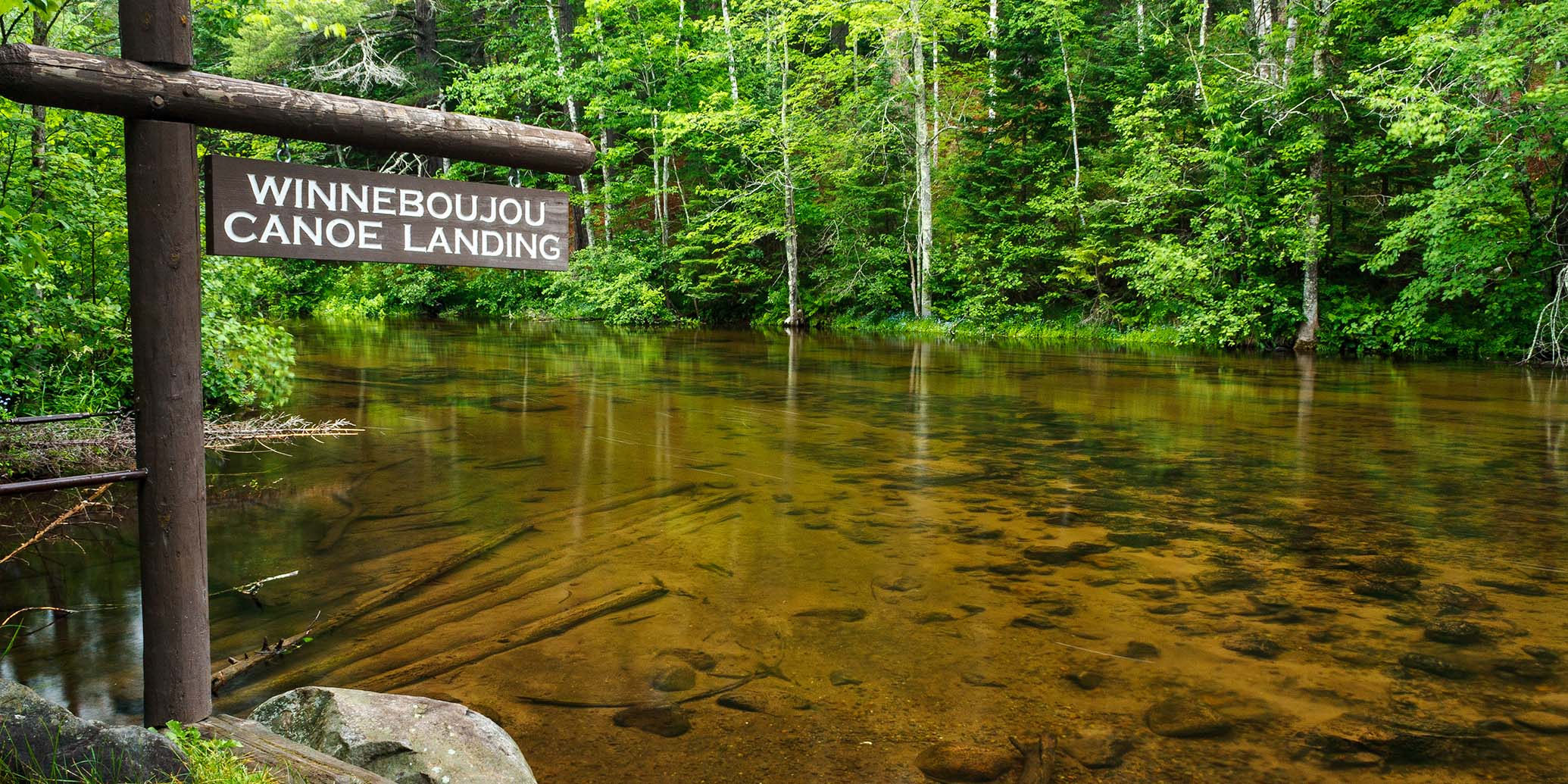
As the river approaches Winneboujou Landing, trees often arch overhead creating an intimate natural tunnel. The water is remarkably clear, look for trout swimming in place downstream of submerged logs and vegetation.
Williamson Rapids and Hall Rapids (both class I) occur below Winneboujou where the trees again arch overhead. A brief stretch of brushy marsh follows, then the river bends into Long Nebagamon Rapids (class I).
As you paddle on, the steep forested walls of the narrow river valley become more noticeable, and the most challenging whitewater of this segment occurs near the end, at Little Joe Rapids (II).
Vehicle Admission Sticker
You must have a Wisconsin State Park Vehicle Sticker (daily or annual) to use the Bois Brule Landing. A popular, alternate take-out for this segment is at the Winneboujou Landing, which is free and shortens the trip to 8.9 miles.
River Camping
The Bois Brule Campground and Canoe Landing is located at the end of this segment. The rustic, family campground is part of the Brule River State Forest and offers 22 shady campsites in a beautiful hillside setting shaded by tall pines. Five sites are walk-in (tent only), of which two are canoe campsites. Seventeen sites can accommodate tents and/or an RV/trailer (max length varies). Each site has a picnic table and a fire ring. Amenities include a riverside picnic area, drinking water, and vault toilets. There are no electric hookups. All 22 campsites require a reservation either online or by phone. You may reserve a site on the day of your arrival.
Season
Water levels are usually navigable from spring through fall. Novice paddlers should avoid the river when water levels are high, especially during the snow melt-off in spring.
River Level Information
The river gauge referenced below is located in this segment and should provide an accurate indication of current conditions in this reach.
River Gauge Location: Brule, WI
USGS Website: 04025500
Phone: Brule River State Forest ~ 715.372.4866
Estimated Difficulty at Gauge Flow
| Below 125 cfs |
Paddling not recommended. |
| 125 cfs to 200 cfs |
Low runnable flow. Several rapids will be bony in this range. Scenic whitewater trip for novice paddlers. |
| 200 cfs to 350 cfs |
Medium runnable flow for novice paddlers. Little Joe Rapids are class II. Fun whitewater trip for novice paddlers. |
| 350 cfs to 600 cfs |
High runnable flow for novice paddlers. Some waves may scare or flip less-experienced paddlers. Fast current in constrictions, especially in BB1. |
| 600 cfs to 1000 cfs |
Novice paddlers should avoid the river. BB1 and BB3 are intermediate runs. Fast current in constrictions, especially in BB1. |
| Above 1000 cfs |
Rare, high flows. Experienced paddlers only. Ripping fast current in constrictions. Deadfall and strainers become quite hazardous when present, may be unavoidable at times! |