Below Strong Falls, the river runs a little wider than before with more riffley shallows. A northern hardwood and conifer forest provides beautiful scenery. Small hills occasionally border the river with steep, tree covered slopes. Apart from stretches of riffles, this segment is mostly flatwater with two low-hazard rapids worth noting at Skinners' Elbow (class I-II) and scenic Wilson's Rapids (class II).
The combination of: a beautiful river, limited development, and very little whitewater creates a great, scenic run for novice paddlers. This trip is highly recommended when river levels are adequate!
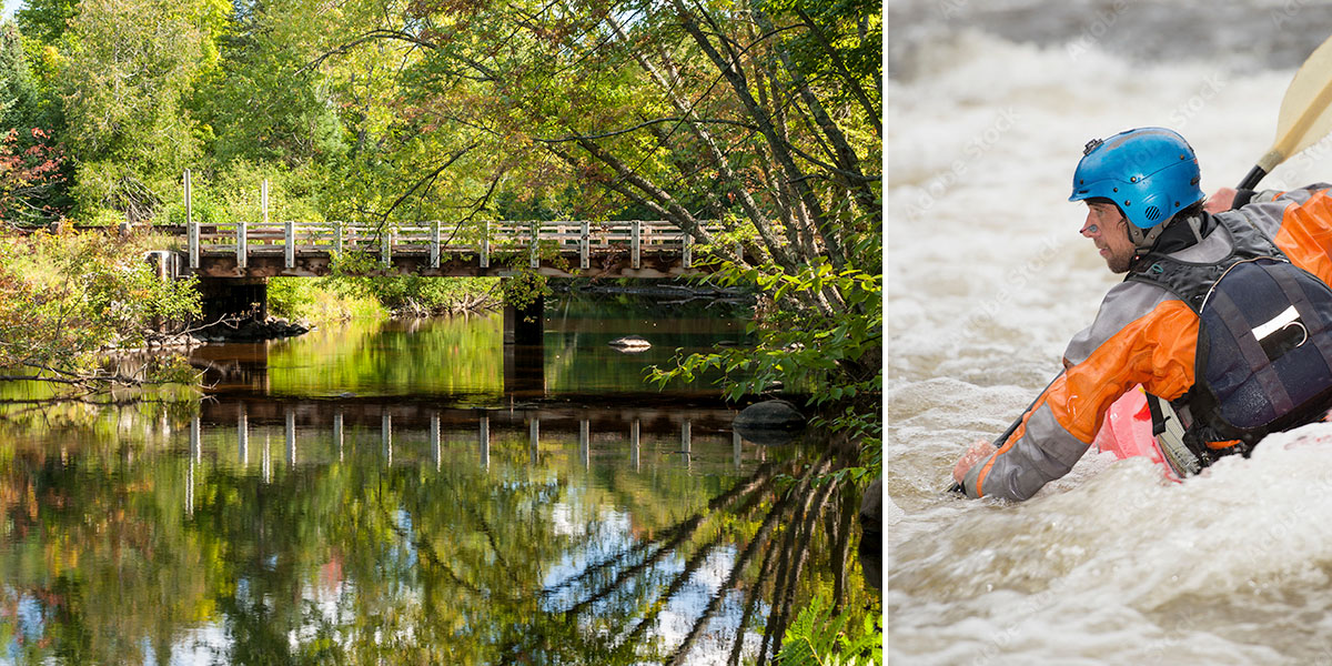
Another of Marinette County's, excellent parks is located in the middle of this segment at McClintock Park. The scenic and well-maintained day-use area is a nice place to get out and stretch your legs, rest a little and have a bite to eat. In fact, if you're looking for a pleasant afternoon float with a nice break in the middle, then this trip is highly recommended!
Even though Strong Falls, a class IV rapid, is located at the start of this segment, you don't have to run the falls if you don't want to. Most whitewater kayakers who run the Falls either only do the Falls, or run them as a finale to the previous segment. Either way there is an easy put-in just below the Falls at Goodman Park, so don't be intimidated by their presence! Of course you can always snap a few pics of the Falls and maybe, ...you know, ...lie to your gullible friends about what an awesome adventure you had!
River Camping
There are a pair of beautiful Marinette County Parks on the Peshtigo River in this segment at Goodman Park* (at the put-in) and McClintock Park*. Both feature scenic day-use areas and hiking trails with footbridges that span the river. Each park also features a small campground with river access. Both campgrounds have reservable sites.
All four of the local rafting/shuttle services also have excellent campgrounds, and all are located on, or very close to, the Peshtigo River. There are links to their webpages on the Local Area Directory page.
Season
This segment is best run from late spring through mid-summer, and after a sustained rainfall from mid-summer through fall. Contact one of the local outfitters for river levels before you paddle!
River Level Information
The river gauge referenced below is about 4.6 miles downstream from the end of this segment. This gauge should provide a fairly accurate indication of conditions in this reach. At higher levels, strainers, and deadfall laying across the river become more of a hazard.
(Numbers in parenthesis reference the Paddler’s Gauge at Highway C)
River Gauge Location: Hwy C Bridge near Wabeno
Suggested Minimum Level: 4.5 feet
USGS Website: 04067958
Estimated Difficulty at Gauge Flow
| Below 4.5 feet |
(0 - 6) Paddling not recommended. |
| 4.5 feet to 5.0 feet |
(6 - 12) Low runnable flow. Some rapids & riffles may be scrappy at the lower end of this range, though all rapids should be navigable. |
| 5.0 feet to 5.8 feet |
(12 - 22) Medium runnable flow. Should be excellent paddling conditions. |
| 5.8 feet to 6.5 feet |
(22 - 30) High runnable flow for most novices to run comfortably. Skinner’s Elbow is class II. Fast current & larger waves developing at Wilson’s Rapids which is approaching class II-III at high end of this range. |
| 6.5 feet to 7.5 feet |
(30 - 42) High runnable flow. Novice paddlers should avoid the river. Skinner’s Elbow is strong class II. Wilson’s Rapids are wavy & fast class II-III. |
| Above 7.5 feet |
(Above 42) Rare, unusually high flows. Exercise caution if you paddle the river in this range. Mistakes compound quickly. |