Paddling the South Fork
The South Fork Flambeau River begins at the historic Round Lake Logging Dam on the west shore of Round Lake in the Chequamegon Nicolet National Forest, about 23 miles west of Minocqua. This small river meanders southwest for 59 miles to the confluence with Flambeau South Fork in the heart of the Flambeau River State Forest.
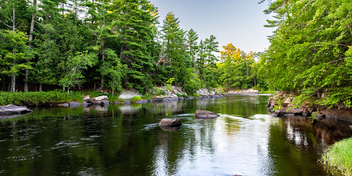
The upper reaches pass through the National Forest and offer a scenic, creek paddling experience through pine and hardwood forests and areas of open marsh. There are a few riffles and low-hazard rapids, but paddlers will find mostly calm waters. There is almost no development along the river. A few homes and resorts dot the banks where the river leaves the Chequamegon-Nicolet, but their presence is minimal.
The river widens and deepens in the middle reaches as spring-fed creeks add their flow. Hardwood and pine forests continue to surround the river with a few stretches of marsh and bog. Long stretches of quietwater are predominant with occasional riffles and a few low-hazard rapids.
At about the halfway point (31 miles), the river passes under the Highway 70 Bridge at the eastern edge of the sleepy town of Fifield. A small riverside park provides access to a convenience store if you need to pick up supplies.
The two most challenging rapids of the middle reach occur mear Lugerville at Boars Rapids (class II-III) and Rocky Carry Rapids (class II-III). Both can produce big waves during high flows.
Below Lugerville, the lower reaches feature more long stretches of flatwater and with several named class II rapids. Scenic wooded islands begin to appear as the South Fork continues to deepen and widen. The rocky river-bottom becomes more noticeable at Cornsheller Rapids (class II) about a half-mile after the river enters the Flambeau River State Forest, and widely dispersed boulder gardens are common downstream.
Below County Highway M, the river passes through the Little Falls-Slough Gundy Scenic Area which features pine-covered rock formations, dalles, and small rocky islands as well as a pair of rapids for advanced and expert paddlers. First is Slough Gundy Rapids (class III) followed by Little Falls (class IV). During low-to-normal flows the rapids are a bit tame and the falls are bony. However, during higher flows playboaters will enjoy Slough Gundy’s fun wave-trains and Little Falls short drop, powerful waves, and holes. Riverside footpaths in the Scenic Area make it easy for an afternoon of fun short-runs of the rapids and falls. Most paddlers need to be wary and portage Little Falls.
The river is mostly slow and quiet after Little Falls. A few sets of boulder fields and rapids occur in the final five miles to the confluence with the South Fork Flambeau.
River Restoration Projects
Sections of the upper South Fork underwent river improvement projects by the US Forest Service. The projects restored the river channel to its’ historic width and depth prior to the logging era of the late 19th century. Several stretches of river were deepened and narrowed to improve habitats for aquatic species and provide better recreational opportunities for canoeing and kayaking.
Flambeau River State Forest
More than 77 miles of the Flambeau River North Fork and South Fork flow through the beautiful Flambeau River State Forest. Originally established in 1930 with 3,000 acres set aside for public ownership, today, the State Forest encompasses over 90,000 acres of scenic hardwood and pine forests. This is one of the largest, mostly undeveloped public-use areas in Wisconsin, where visitors will find mile after mile of remote and wild, scenic beauty.
Canoe Camping on the South Fork
There are no State Forest canoe campsites on the South Fork.
Camping in the Flambeau River State Forest
Two Flambeau River State Forest campgrounds are within a short driving distance of the Flambeau River South Fork. Connors Lake (29 sites) is an excellent family campground that is open from the late May through early September. Lake of the Pines (30 sites) sits on a wooded hill next to a scenic lake and is open from mid-April to December. Both are rustic, non-electric campgrounds and every campsite in both are reservable.
Season
The best paddling is usually from late-spring through mid-to-late summer. Water levels on the South Fork can fluctuate greatly, it may not be as noticeable in the calmer sections but the changes in the rapids can be quite dramatic. This is mainly dependent on spring snow melt and rainfall. Novice paddlers may find that certain class II to be a blast one day, then come back a couple of weeks later and the same rapids will look and behave completely different. So every rapids should be scouted, regardless of your skill level and past experience.
River Level Information
Phone: 715.332.5271 (Flambeau River State Forest)