Flambeau River State Forest
More than 77 miles of the Flambeau River North and South Forks flow through the beautiful Flambeau River State Forest. Originally established in 1930 with 3,000 acres set aside for public ownership, the State Forest encompasses over 90,000 acres today. This is one of the largest, most undeveloped public-use areas in Wisconsin, where paddlers will find mile after mile of remote and wild, scenic beauty.
Paddling the North Fork Flambeau
The North Fork Flambeau River is a popular paddling destination in northern Wisconsin that features long stretches of flatwater and several segments of class II whitewater. There are 14, widely dispersed, canoe campsites where the river flows though the Flambeau River State Forest. Combined with minimal development and beautiful wilderness scenery, the North Fork is a wonderful choice for multi-day trips.
The river begins at the west shore of the scenic Turtle-Flambeau Flowage at Turtle Dam about 20 miles northwest of Park Falls. The first eleven miles features more than a dozen low-hazard rapids and several stretches of flatwater. Hardwoods often overhang the banks and occasional, pine-covered rock formations and dalles occur where the river rushes through rapids. This is an excellent small river run for novice whitewater enthusiasts.
The river slows, widens, and homes and development begin to appear as it approaches Park Falls. Four portages are required over the next 12.3 miles, first at a large mill dam and a second about a mile-and-half further down, at Lower Park Falls Dam just above Highway 13. Another pair of dams, Pixley Dam and Crowley Dam, form small flowages below Park Falls. The river enters the Flambeau River State Forest a mile below Crowley Dam.
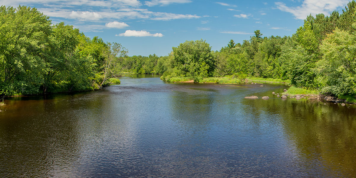
Below 9 Mile Creek, the river widens and deepens as more creek tributaries add their volume. The next 21 miles are mostly flatwater with occasional riffles and one low-hazard rapid in a quiet wilderness setting. Hardwoods and pines cover the riverbanks. Five canoe camps are scattered throughout this reach which is popular among anglers.
Camp 41 Landing to Beaver Dam Landing is a popular day trip for novice whitewater enthusiasts. This segment features rocky shoals, riffles, and class II+ rapids that are a blast to run, especially after Hervas Camp Landing where Cedar Rapids (class II) and Beaver Dam Rapids (class II-III) are located. Both are highlights of this segment.
Wildlife along the river includes warblers, finches, ducks, bald eagle, osprey, white-tailed deer, black bear, raccoon, fisher, and otter. Wolves and coyotes are rarely seen but occasionally heard, yapping and crooning on clear, moonlit nights. They’re usually much farther away than they sound …usually.
For now the section between Park Falls (end of FN1) and 9 Mile Creek (start of FN3) is not featured in this guide. This segment will be added by August 1st 2024.
River Camping
The Flambeau River North Fork has 14 riverside canoe campsites where it flows through the Flambeau River State Forest. The camps are well-maintained and each offers three separate campsites, most have plenty of shade. Each camp has a pit toilet, and each site has a fire ring and a picnic table. The sites are available on a first-come, first-served basis and each camp is limited to a one-night stay. There is no fee for camping.
Glass beverage containers are not allowed on the river!
Camping in the Flambeau River State Forest
The Flambeau River State Forest has two family campgrounds within a short driving distance of the Flambeau River. Connors Lake (29 sites) is an excellent family campground that is open from the late May through early September. Lake of the Pines (30 sites) sits on a wooded hill next to a scenic lake and is open from mid-April to December. Both are rustic, non-electric campgrounds and every campsite in both are reservable.
Camping in the Chequamegon
The Chequamegon-Nicolet National Forest has a pair of family campgrounds within a short driving distance of the Flambeau River. Both offer reservable sites. First is scenic Black Lake, located about 30 miles northwest of the Highway 70 Bridge at Oxbow (FN3). Many of the 29 campsites are lakeside, and all are reservable.
In the opposite direction is Sailor Lake Campground, located next to a scenic northwoods lake inside the Medford/Park Falls District. The campground lies in a dense forest and offers plenty of seclusion. There are 25 reservable sites.
Season
Generally good paddling throughout spring, summer and fall. Less experienced paddlers should avoid the river during the winter melt-off in early spring, and after a sustained heavy rainfall. High water levels can produce dangerously high waves in several of the rapids. Call the WDNR State Forest Office at 715.332.5271 for water level information.
River Level Information
Phone: 715.332.5271 (Flambeau River State Forest)