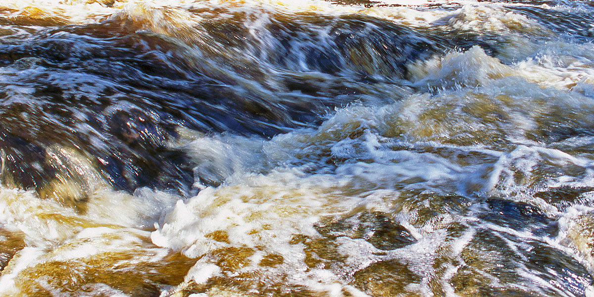
This is one of the more memorable whitewater runs in Wisconsin, a 2.2-mile stretch through the narrow Montreal River Canyon, where conglomerate and sandstone walls tower up to 200 feet above the river. The scenery is among the best in the upper-Midwest and is unlike anything else in the region. Inside the canyon, the river rushes through long stretches of class II and class III rapids to challenge intermediates with several fun playboating holes for advanced paddlers. Another one of those bucket list runs for Wisconsin and Michigan's UP.
A hydro-dam is just upriver from this section so the runnability is completely dependent on dam release. And, like most small whitewater rivers, the character changes dramatically depending on water levels. During very high flows, the river serves up big wave-trains and fun holes that are well-suited for advanced level playboaters. Intermediate paddlers will especially enjoy the river in the roughly 500 to 900 cfs range (this is an estimate!) where the waves shouldn’t be too pushy, and the holes aren’t too sticky.
At flows below 400 cfs, the river’s rocky riverbed becomes more prevalent and many of the rapids fall into the class II range. Paddlers will find several fun ledges and drops, but also dense boulder gardens and short stretches where you may have to step out and tow. 250 cfs is likely the absolute minimum to run the Canyon.
The most challenging rapid is ‘The Cathedral’, where the river bends sharply to the right at the foot of a sheer cliff on river-left. A sticky, diagonal hole forms from river-left, and intermediate paddlers need to be especially wary. From upriver it's easy to underestimate, but it can stop small rafts at flows over 600 cfs and will be scary if you get stuck in the powerful hydraulics.
The middle and lower Montreal River forms part of the border between Wisconsin and Michigan's Upper Peninsula. The Montreal River is one of the few rivers in the US that flows north, emptying into Lake Superior.
Hazards
While the canyon has beautiful scenery, it also creates a precarious situation, once you’re in, you can only paddle out. Jim Rada, author of 'Northwoods Whitewater', states that in the interest of safety, ‘...it's good to have a group mentality here’. Also, you should have at least one person in your group with river-rescue knowledge.
The rapids won't overpower most experienced whitewater paddlers, however, be honest with yourself about your skill level, if class III rapids pushes your comfort zone, you shouldn't attempt this run.
Always wear proper safety gear, don't paddle alone, and be sure to let a friend or relative know where you are and the latest time estimate on when you plan to finish your run.
Season
For most of the summer and fall, the river will run at 250 cfs or lower and be be a shallow, bony, class II that is barely navigable. During a summer/fall dam release, or right after the snow melt-off (end of April through early May?), the character of the river changes dramatically - producing a fantastic class III run for rafting and kayaking at levels around 600 cfs and higher
River Level Information
River Level Info: Excel Energy hotline (voice-recorded): 715.893.2213
Superior Falls Scenic Area
The Montreal River Canyon is about a mile upriver from Superior Falls (110 feet). The entrance to the Superior Falls Scenic Area is a half-mile north of the Highway 122 Landing in Michigan, on County Road 505. An overlook and a riverside trail offer views of the main waterfalls and the pool at the base of the falls. A beautiful pebble and sand beach on the Lake Superior Shoreline lies next to the mouth of the Montreal River and features excellent views of sea cliffs that extend to the east and west.