The Border Brule
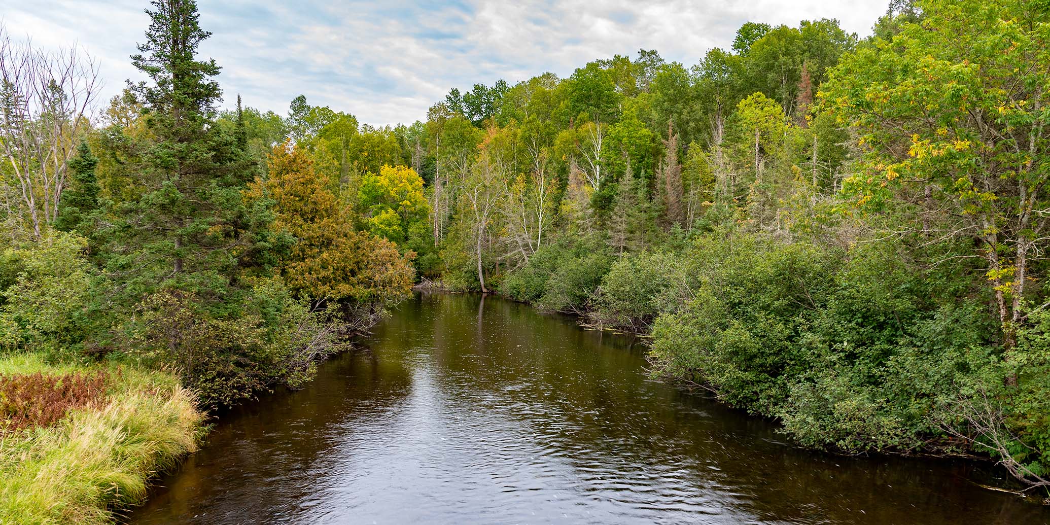
The Brule has an intimate, small-river character that provides a scenic float through a remote wilderness setting. Development is minimal and road bridges are few and far between. All combine to provide a relaxing, 'get-away-from-it-all' experience for canoers and kayakers.
Most of the Brule forms part of the border between Wisconsin and upper Michigan and is surrounded by protected lands. On the Wisconsin side is the Chequamegon-Nicolet National Forest, while the Michigan DNR owns most of the land on the Michigan side.
As you float downriver, the landscape varies from small rolling hills with steep wooded banks, to spruce and tamarack bog, to open wetlands. Brushy thickets and dense forests of aspen, maple, birch, cedar, spruce, balsam fir, and red pine are common.
Wildlife is abundant, especially in the morning and afternoon hours. White-tailed deer, beaver, muskrat, raccoon, and river otter are common. Bird-life includes wood ducks, merganser, belted kingfisher, spotted sandpiper, several species of warblers, and if you’re lucky, a great blue heron. The river is also a popular trout stream populated with brown and brook trout.
The Brule is mostly quietwater with occasional rapids and riffles, most are located just above and below the Pentoga (FR 2446) Bridge in Segment B2.
Early French explorers named the river 'Brule', which means 'burnt'. The forest near the confluence with the Menominee had been decimated by wildfires around the time the explorers first arrived. The Chippewa name for the river is "We-sa-co-ta".
River Camping
There is one canoe camp in segment B1, and two canoe campsites in segment B2. Camping at these sites is free and availability is on a first-come, first-served basis. Please limit your stay to one night only! All three camps are primitive.
Camping in the Chequamegon
The Chequamegon-Nicolet National Forest in Wisconsin has 14 campgrounds within 30 miles of the Brule River. Nearly all are located on scenic northwoods lakes and two offer online reservations.
The Franklin Lake Campground is one of the most popular family campgrounds in the entire Cheq-Nicolet National Forest. There are a total of 77 reservable sites in two campgrounds (North and South) beneath tall pines and hemlocks next to a crystal-clear, 880-acre lake. Activities include: a swimming beach, boating, fishing, an interpretive center, naturalist programs and several hiking trails inculding the Franklin Nature Trail, which is featured in this guide.
Morgan Lake Campground is about 22 miles south of the Highway 139/189 Bridge Landing (B1 and B2). This quiet, secluded campground sits next to a small 45-acre lake and features 18 individual sites and a shady, reservable group site that holds up to 25 people - excellent for family camping! The group site and nine of the individual sites are reservable.
Season
The river is usually navigable throughout spring, summer and into fall. It can be scrappy in places during periods of little rainfall.
River Level Information
River Gauge Location: US Hwy 2 Bridge, MI (north side)
Suggested Minimum Level: 220 cfs / 3.5 feet
USGS Website: 04060993