

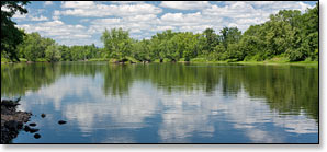
St Croix River
(SC5) Norway Point Landing to Highway 70 Landing, Wisconsin Trail Guide
Trail Facts
| Distance: | 14.3 miles |
| Skill Level: | Novice |
| Whitewater: | Class II |
| Approx. Paddle Time: | 6-8 hours |
| Elevation Drop: | 68 feet |
| Average Gradient: | 4.7 fpm |
Synopsis
Trail Review
The reach between Nelson’s Landing and Highway 70 has the steepest gradient of the entire St Croix River. Combined with a wide, shallow and rocky river-bottom, and fast moving water means paddlers will find numerous riffles, class I and class II rapids. This segment also features two of the most scenic geologic features of the Riverway: the Kettle River Slough and Sandrock Cliffs.
The Kettle River Slough is a named fork of the St Croix River which branches off about a half-mile below Nelson's Landing. The Slough forms the right fork around a pair of large, densely wooded islands and several smaller islands. Paddling the Slough is loads of fun in medium to high water, but usually too shallow to navigate in in low water conditions.
The current is moderate to fast through the islands in both channels, especially wherever rapids are located. The deeper main channel runs down the left fork and is usually navigable throughout the summer. Both forks have class II rapids that will become 'pushy' at high water levels. The most significant whitewater is at August Olsen Rapids, a class II located at the confluence of the two forks.
At Sandrock Cliffs, tall, tree-studded sandstone bluffs tower over a narrow island channel from the left bank (Wiscosnin side). The bluffs are very scenic and are among the most photographed features of the St Croix River. A hiking trail leads from the river to the top of the cliffs where several hike-in campsites are located.
If you’re comfortable running low-hazard rapids and are only going to paddle one segment of the St Croix River... This one is highly recommended!
Canoe/Kayak Camping
The National Park Service has eleven individual and eight group campsites in this segment. Individual sites accommodate up to three tents and/or eight people, while the group sites hold up to six tents and/or sixteen people. There are no fees for accessing, camping, or parking in any of the National Scenic Riverway areas. There is a three night limit of stay. All sites are on a first-come, first-served basis. No glass beverage containers are allowed on the riverway!
Season
This segment is generally navigable throughout the warm-weather season. Paddlers should exercise caution in high water conditions. The Kettle River Slough can be too shallow to navigate in low water conditions.
River Level Information
On the Web: St Croix National Scenic Riverway website
Phone Contact: NPS Namekagon Visitor Center, 715.635.8346