

St Croix River
(SC1) Gordon Dam to Dry Landing, Wisconsin Trail Guide
Trail Facts
| Distance: | 13.2 miles |
| Skill Level: | Novice |
| Whitewater: | Class II |
| Approx. Paddle Time: | 6 hours |
| Elevation Drop: | 91 feet |
| Average Gradient: | 6.9 fpm |
Synopsis
Trail Review
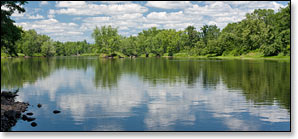
The upper reaches of the St Croix are narrower than the more popular reaches further down-river. The character of this segment is fairly rugged and remote with numerous stretches of rocky rapids. The landscape varies from wide open marsh with grassy banks and alder thickets, to dense forest of mixed hardwoods, spruce and pine. A large number of islands fork the river throughout, their cover is equally as varied as the surrounding landscape, from dense forest to open grasses.
There are several pitches of rapids that will suit novice whitewater paddlers during medium to high flows. The rapids often occur in rocky, wavy, high speed chutes through tight constrictions. Coppermine Dam Rapids are the most notable, and they occur at the ruins of an old sluice dam. However, it is recommended that you portage the Coppermine Dam due to the presence of submerged steel spikes that can be very dangerous to paddlers. Scout Chute, Scott Rapids and Bear Trap Rapids are other low-hazard whitewater rips worth noting.
The scenic beauty, abundant wildlife, and a lack of development, combine with the occasional rugged nature of the river to make this a notable trip.
Canoe/Kayak Camping
The National Park Service has two individual and four group campsites in this segment. Individual sites accommodate up to three tents and/or eight people, while the group sites hold up to six tents and/or sixteen people. There are no fees for accessing, camping, or parking in any of the National Scenic Riverway areas. There is a three night limit of stay. All sites are on a first-come, first-served basis. No glass beverage containers are allowed on the riverway!
Season
The best paddling is usually in May and June, thereafter following an extended rainfall from July through September. This segment is often navigable into late fall, but you may have to walk through some shallow riffles and rocky rapids.
River Level Information
On the Web: St Croix National Scenic Riverway website
Phone Contact: NPS Namekagon Visitor Center, 715.635.8346