

Popple River
(PO1) FR 2398 Bridge to Morgan Lake Road Bridge, Wisconsin Trail Guide
Trail Facts
| Distance: | 11.0 miles |
| Skill Level: | Novice |
| Whitewater: | Class II |
| Approx. Paddle Time: | 5-6 hours |
| Elevation Drop: | 65 feet |
| Average Gradient: | 6.0 fpm |
Synopsis
Trail Review
This reach features long stretches of flatwater with occasional riffles and several pitches of rocky, class I and II rapids. The most noteable whitewater is at Burnt Dam Rapids, a class II that occurs in two distinct pitches 5.7 miles below the FR 2398 Bridge. The long, second pitch of Burnt Dam occurs in a long, rocky, wavy constriction that can be blast to paddle when river levels are adequate. The river is so narrow in the rapids that the forest canopy closes in overhead creating a very cool, tunnel-like effect.
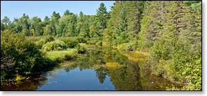
The surrounding landscape varies from open marsh and conifer bog, to a dense lowland forest of mixed hardwoods and pines. Wildlife is abundant. White-tailed deer, otter, beaver, and numerous species of birdlife inhabit the forest surrounding the river.
Season
In angler's terms this is a 'freestone' river, fed more by snow-melt in the spring and rain during the summer and fall, than by natural springs. Although several springs feed into the river their flow is not enough to sustain sizeable water levels suitable for paddlers throughout the summer, especially with the number of rapids you will encounter. The best paddling is in the spring and early summer, and after a sustained rainfall in mid to late summer.
River Level Information
Suggested Minimum Level: 150 cfs
Suggested Maximum Level: 800 cfs
USGS River Gauge: 04063700 - FR 2159 Bridge near Fence, WI
The river gauge referenced below is located in this segment and should provide an accurate indication of current conditions in this reach.
Estimated Difficulty at Gauge Flow
| Below 150 cfs |
Paddling not recommended. |
| 150 cfs to 250 cfs |
Low runnable flow. Scenic river trip for novice paddlers, rapids may be scrappy. |
| 250 cfs to 500 cfs |
Medium runnable flow. Challenging whitewater river trip for novice paddlers. Rapids become pushy for less-experienced paddlers above 400cfs. |
| 500 cfs to 800 cfs |
High runnable flow. Intermediate and advanced whitewater paddlers only, rapids are wavy and pushy. Watch for strainers and deadfall. Novice paddlers should avoid the river. |
| Above 800 cfs | Paddling not recommended. Riverbanks overflowing, strainers and debris are very hazardous when present. |
Visual Gauge
For on-site, visual reference, see the river gauge installed by the staff of the Wisconsin DNR's Wild Rivers Intrepretive Center at the Highway 101 Bridge. The gauge is below the bridge on the north side of the river. Their readings for enjoyable paddling the Popple River above Highway 101 are as follows:
| Below 2 Feet | Paddling not recommended. |
| 2.0 Feet | "Minimum necessary for a decent run." |
| 2.5 Feet | "Considered very good" |
| 3.0 Feet | "excellent" |
Source: "Canoeing the Wild Rivers of Florence County" prepared by the Wisconsin Department of Natural Resources.