

Synopsis
Paddling the Flambeau River
The upper reaches of the scenic Flambeau River are actually two rivers: the North Fork and the South Fork. The North Fork is one of the more popular paddling destinations in northern Wisconsin and features trips suitable for both quietwater and novice-whitewater enthusiasts. The less-traveled South Fork has a number of rapids that are more challenging than those found on the North Fork and is better suited for more experienced canoers and kayakers. Both forks are small to medium-sized rivers, and both eventually converge to form the Flambeau River, which flows south for another 49 miles until it joins the larger Chippewa River.
Both forks are surrounded by a mixed northern hardwood forest with: sugar and red maple, red oak, yellow birch, white ash, and beautiful stands of quaking aspen. Frequent stands of conifers along the riverway include: red, jack and white pines, tall hemlocks, and occasional cedars overhanging rocky riverbanks.
There is very little human development on either fork. Abundant wildlife includes bald eagle, osprey, white-tailed deer, black bear, raccoon, fisher, and otter. Wolves and coyotes are rarely seen but occasionally heard, yapping and crooning on clear, moonlit nights. They’re usually much farther away than they sound, ...Usually.
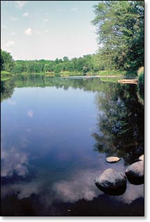
More than 77 miles of the Flambeau River North and South Forks run through the beautiful Flambeau River State Forest. Originally established in 1930 with 3,000 acres set aside for public ownership, the State Forest encompasses over 90,000 acres today. This is one of the largest, most undeveloped public-use areas in Wisconsin, where paddlers will find mile after mile of remote and wild, scenic beauty.
Paddling the Flambeau River
On the North Fork, segments FN2 and FN3 are mostly flatwater runs with some riffles and low-hazard rapids. Segments FN1 and FN4 feature long stretches of fun, low to medium-hazard rapids. When water levels are adequate, FN1 is one of the most enjoyable and scenic, novice-whitewater paddle trips in the state. However, FN4 is likely the most popular trip of the entire riverway and features several class II+ rapids that are a blast to run, especially after Hervas Camp Landing where Cedar Rapids (class II) and Beaver Dam Rapids (class II-III) are located, both are highlights of this segment.
The less-paddled South Fork is a narrower river with a more-rugged character. The scenery is gorgeous with numerous dells, rock formations and small islands. However, water levels are not as consistent. When levels are low, several rapids are unnavigable, especially in FS3. When levels are ‘medium’ to ‘high’: Segments FS1 and FS2 are loads of fun and feature several challenging II+ rapids with long stretches of flatwater. Segment FS3 features a pair of exciting rapids for advanced and expert paddlers: Little Falls, a thundering class 4, and Slough Gundy Rapids, a wavy class II-III. In addition, the riverside footpaths of the Little Falls/Slough Gundy Scenic Area off County M makes an easy and fun short-run of the Falls and Rapids.
Camping
Canoe/Kayak Camping
The Flambeau River North Fork has 14 riverside canoe camps where it flows through the Flambeau River State Forest. The camps are well-maintained and each offers three separate campsites, most have plenty of shade. Each camp has a pit toilet, and each site has a fire ring and a picnic table. The sites are available on a first-come, first-served basis and are limited to a one night stay. There is no fee for camping. Glass beverage containers should not be used on the river!
State Forest Campgrounds
The Flambeau River State Forest has two family campgrounds at: Connor's Lake (29 sites), and Lake of the Pines (30 sites). Both are rustic campgrounds with no electric sites. Connors Lake is open from the Thursday before Memorial Day, to the Tuesday after Labor Day, and offers 29 reservable sites.
Chequamegon-Nicolet National Forest Campgrounds
The Chequamegon-Nicolet National Forest has a pair of family campgrounds within a short driving distance of the Flambeau River. Both offer reservable sites. First is scenic Black Lake, located about 30 miles northwest of the Highway 70 Bridge at Oxbow (FN3). Many of the 29 campsites are lakeside, and all are reservable.
In the opposite direction is Sailor Lake Campground, located next to a scenic northwoods lake inside the Medford/Park Falls District. The campground lies in a dense forest and offers plenty of seclusion. There are 25 reservable sites.
Season
Generally good paddling throughout spring, summer and fall.
Less experienced paddlers should avoid the river during the winter melt-off in early spring, and after a sustained heavy rainfall. High water levels can produce dangerously high waves in several of the rapids. Call the WDNR State Forest Office at 715.332.5271 for water level information.