McMiller Ski Trail
Kettle Moraine State Forest, Southern Unit, Wisconsin Trail Guide
Trail Facts
| Novice: | 2.5k |
| Intermediate: | 15.4k |
| Advanced: | 10.6k |
| Grooming: | C+S |

Click or Tap for Local Forecast
Synopsis
Trail Review
LOCATION
Between Palmyra and Eagle.
McMiller Sports Center
S103W38754 County Road Nn
Eagle, WI 53119
TRAILS
Grooming: Classic & skate. Multiple loop trail system.
Snowshoe Trails: No.
TRAIL NOTES
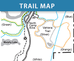
McMiller is an excellent multiple-loop trail system through a nice variety of terrain and scenery. The terrain varies from flats, to rolling hills, to a few steep hills. The trails pass through long stretches of mixed hardwoods and several sections of pine plantations. Several prairie openings provide scenic views of the surrounding forest.
The trails are groomed for classic and skate and are mostly intermediate-level. Although the Blue Loop is marked as Most Difficult, a solid intermediate-level skier should have no problems skiing it. Blue Loop is also a great trail to train for your next loppet.
* In total, there are 17.6 km of trails. However, if you were to ski each loop independently your total distance would be 28.5 km since most of the loops partially overlap.
McMiller offers a paved parking area, a heated warming building (at the trailhead), drinking water, and pit toilets. The trails are all well-marked with color-coded markers, mileage signs, and there are trail map signs at most junctions.
“McMiller also offers a biathlon course for those who participate in this unique sport that combines physically demanding cross-country skiing with rifle marksmanship. The biathlon range at McMiller is open for use from during daylight hours seven days a week.”_Wisconsin DNR
LAND OWNERSHIP
The entire trail lies within the Kettle Moraine State Forest, Southern Unit, WI DNR
FEES
Wisconsin DNR Vehicle Admission Sticker Required
WI License Plate Daily: $8
WI License Plate Annual: $28
Out-of-State Daily: $13
Out-of-State Annual: $38
Wisconsin State Trail Pass also required (16 or older)
Daily: $5
Annual: $25
FACILITIES
Parking, warming building (heated), water, pit toilets
On-Site Equipment Rentals: No
IN THE AREA
Motels, food, gas (Palmyra, Eagle), Motels, food, gas, retail sporting goods (Muckwonago, East Troy, Milwaukee)
DIRECTIONS
Both directions below are to the main trailhead.
Eagle: From the west intersection of Highways 59 & 67, drive west on Highway 67 for 2.8 miles and turn west onto County NN. Drive west on County NN for 0.5 mile and turn north onto Walters Rd. The McMiller Sports Complex is at the end of this road.
Palmyra: From the intersection of Main Street & 2ND Street in downtown Palmyra, drive east on E Main Street (Highway 59 East) for 2.4 miles and turn south onto County Hwy Z. Drive south on County Z for 2.0 miles and turn east onto County NN. Drive east on County NN for 1.3 miles and turn north onto Walters Rd. The McMiller Sports Complex is at the end of this road.
TRAIL INFORMATION
Website: Kettle Moraine State Forest - Southern Unit
Phone: 262.594.6202 (Kettle Moraine State Forest, Trail Information)

